")
THE GAME
Aerial Photography and Video Production Services
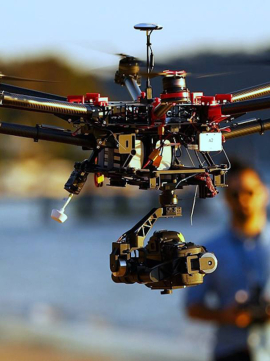
Quadcopters generally use two pairs of identical fixed pitched propellers; two clockwise and two counterclockwise. These use independent variation of the speed of each rotor to achieve control. By changing the speed of each rotor it is possible to specifically generate a desired total thrust to locate the center.

Featured Services

- Weddings
- Outdoor Festivals
- Promotional Events
- Concerts
- Team Sports

- Commercial Real Estate
- High-End Residential Flyovers/Walkthroughs
- Country Clubs/Golf Courses
- Schools/Universities
- Website Design
- Marketing Tools
- Promotional Videos
- Construction
- Real Estate
- Landmarks and Cityscapes
- Residential/Landscape
Operating Area
We currently operate in the Brooklyn area. Businesses outside of a 20 mile radius may require travel expenses. Please contact for more details.
Our Team
Who We Are
With hundreds of hours in flight, our unique cinematic approach is solidly rooted in a decade of professional experience. Our studio’s strength lies in our diverse backgrounds in architecture, cinematography, photography and graphics.

Jason Parkett
Creative Director
Quadcopters differ from conventional helicopters, which use rotors that are able to vary the pitch of their blades dynamically as they move around the rotor hub. In the early days of flight, quadcopters were seen as possible solutions.
We Love our Clients, And They Love Us
Recent Posts
Project Title: Pre-Feasibility Mapping of Rural Roads (Motinagar-Bijayapur-Talladehi section)Client Name: Sermanthang Village Women Development CommitteeProject Status: CompletedCategory: Road Survey We mapped a 26 km section of road (Motinagar-Bijayapur-Talladehi section) in a remote area of Nepal.A project of this size in the rural hills would typically take around 20 days of work with traditional ground surveying methods (Total Station and sometimes…
Project Title: Aerial Mapping of Sermanthang Village, Sindhupalchowk for Reconstruction PlanningClient Name: Sermanthang Village Women Development CommitteeProject Status: CompletedCategory: Planning and reconstruction We, with two other local partners took a 6 hour bus ride, followed by a 2 hour hike, East of Kathmandu to the beautiful village Shermathang. At an altitude of 2,600 meters, Shermathang boasts scenic beauty and a…
Project Title: UAV survey and master-planning for village relocation in KhotangClient’s Name: Rupakot-Majuwagadi Rural MunicipalityProject Status: CompletedCategory: Surveying, Master-planningMajor Outputs: Topographical maps, Contour map, Layout map, Master plan In order to find the usability of a new place for village relocation planning, lots of time is required for recognition of the potential sites and then for their study. It’s a…